


Knik River Road: a different side of the Valley
South of the Knik River, the road follows a broad glacial valley beneath Pioneer Peak. This is a corridor search: where you are along the road matters as much as the Palmer address.
Banner: Regional Pioneer Peak and Matanuska River. Photo: iStock.com/Alan Musy - ADM PhotoGraphics. Regional context, not a view from a listed property.
Follow the road, not the mailing label
Knik River Road belongs to the south side of the Knik River valley. From the Old Glenn Highway crossing, the road heads east beneath the mountain wall. Our map highlights a corridor along that settled route and the nearby Old Glenn approach, rather than coloring the entire backcountry as a residential neighborhood.
The river, gravel bars and rising Chugach terrain give this part of the Valley a different scale. Scattered homes, cabins and larger parcels sit along a linear road network. A property near the Old Glenn junction and one farther east can share a general area name while having quite different day-to-day trips.
It is also important not to confuse Knik River Road with Knik-Goose Bay Road southwest of Wasilla. They are separate places on different sides of the Valley’s road system. Here, use the Knik River crossing and Pioneer Peak as your reference points, then read each listing’s position along the corridor. That simple distinction saves a lot of unhelpful searching.
Knik River Road on the Palmer map
Gold is this guide’s area; neighboring areas stay grey. Tap a shape for its guide, or a numbered hotspot for a public landmark.
One finger scrolls the page. Pinch or use + / − to zoom. Tap “Move map” to pan with a finger, then “Done moving map” to return to page scrolling.
Boundaries are approximate, not legal lines. Original Palmer outlines are retained from Mat-Su Borough community councils and city limits; Knik River Road is a drawn road corridor. Trail pins use Borough coordinates. Depot and park pins are approximate OpenStreetMap centers, not parking entrances. Public destinations may sit outside this guide’s area.
Sources: Mat-Su Borough — Community Council Maps · OpenStreetMap landmark locations
One corridor, several very different destinations
The Old Glenn Highway links this side of the river with the Butte and Palmer to the north and the main Glenn Highway corridor farther west. Knik River Road extends east from the Old Glenn. The first part of any daily trip is therefore the distance along the river road itself.
For Palmer, the route uses the Old Glenn connection across the Knik and onward through the Butte. Wasilla is a different cross-Valley destination. Anchorage and JBER trips join the main Glenn corridor, and the appropriate gate depends on where you are going on base. The chooser below uses a representative point near the Pioneer Ridge trailhead, not the far end of the road.
A useful visit follows the route beyond the one driveway you came to see, then returns to the highway junction. That gives you a sense of the corridor’s shape and the connection back to services. Do the actual destination trip as a separate comparison instead of treating “Palmer” in the address as an in-town commute.
Where does your day take you?
Tap a destination to compare the same starting point: Knik River Road near Pioneer Ridge trailhead.
Downtown Palmer · 14.2 miles
Route: East Knik River Road → Old Glenn Highway → East Arctic Avenue → South Alaska Street
No-traffic OSRM model estimates, rounded up to five minutes; not measured rush-hour or winter trips. Your driveway, traffic and weather add time. JBER ends at the Boniface Gate checkpoint and excludes queues and travel on base. Choose the gate for your actual destination.
Sources: OSRM / OpenStreetMap routing · Alaska 511 · JBER — Base Access / PCS overview
A mountain trail above a broad river landscape
Pioneer Ridge–Austin Helmers Trail is the clearest named public trail destination on the south side of the river. The Borough describes a route that begins in forest and climbs onto the northeast slope of Pioneer Peak. It is a substantial mountain outing, quite different from a short riverside stroll. The hotspot marks the official trailhead location.
Across the wider valley, Alaska DNR manages the Knik River Public Use Area. Its landscape includes river braids, gravel bars, lakes and mountain country, with both motorized and nonmotorized recreation. Many familiar access points, including the Jim Creek and Maud Road side, are north of the river. A place visible across the valley is not automatically reached directly from Knik River Road.
The glacier is part of that broader backcountry setting, not a destination we describe as a normal paved-road errand from a home. Use the land manager’s current access and recreation information when planning an outing. For a property visit, simply seeing the trailhead, river corridor and highway approach is already a useful introduction.
A look around the wider landscape
Swipe the strip, then tap a photo to open it full-screen. These licensed regional images show the wider Palmer and Hatcher Pass landscape—not individual neighborhoods, listings or views promised from a home.
Cabins, houses and land with different levels of improvement
This is a rural property search rather than an extension of Palmer’s downtown grid. Listings may include detached houses, cabins and vacant or partly improved land. A property’s level of development matters: an established year-round home, a modest cabin and a building parcel are three different starting points.
Look at the whole arrangement of land and buildings. Where is the house relative to the road? How do the parking area, storage and outdoor space connect? Does a separate building serve the way you actually plan to use the place? The river-valley setting is memorable, but the everyday layout still deserves the same attention as the scenery.
We do not assume that a large parcel can be subdivided or that a cabin can be expanded into any use. Those questions belong in the records review. James Cash and Ryan Lunski can help match your plans to the right type of search, then compare actual properties rather than selling the general idea of a river retreat.
The river valley and public-land story
The Borough recognizes the South Knik River Community Council, and the existing Palmer map uses that council context to draw its narrower road corridor. It is a geographic guide, not a new municipal boundary. The residential road and the wider public-use landscape should remain distinct in the way a home is described.
The Knik River Public Use Area was established in 2006. DNR describes a landscape with multiple kinds of recreation and a mix of land ownership, including private land within the broader area. That helps explain why a public-land map and a property map answer different questions. We have kept exact historic claims about individual cabins out of the guide unless their records can support them.
Rural systems are part of the property itself
Water, wastewater and heating arrangements are individual features of a home along this corridor. Private systems are part of the rural property picture; a cabin may have a very different setup from an established full-time residence. Regional electric service comes through Matanuska Electric Association, while specific connections and capacity belong to the provider’s property-level information.
The practical comparison is what is installed and how it works with your plans. A house with a separate heated building is a different operating setup from one compact cabin. Communications, heating fuel and service access also belong in that picture.
Picture your season here
Seasonal notes with illustrative regional photos—not a matched summer/winter photo pair.
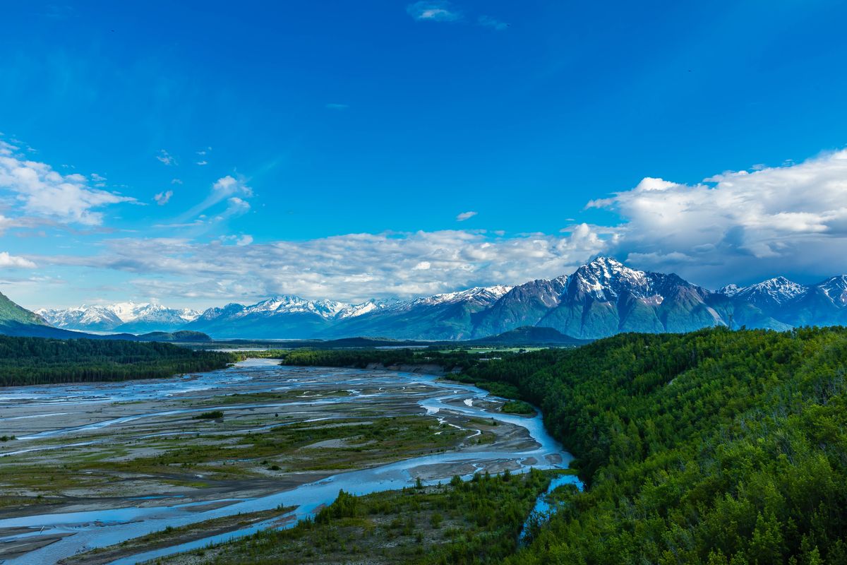
Summer reveals the braided river, green lower slopes and the scale of the glacial valley. Photo: regional Pioneer Peak and Matanuska River; not a Knik River frontage claim.
Photo: iStock.com/Alan Musy - ADM PhotoGraphics
Before you buy here
Tap a topic to open the practical checks. One property, one clear review.
River and ground
Review current flood maps, riverbank erosion history, channel movement, drainage and soils with the appropriate experts. A parcel outside a mapped flood zone can still have erosion exposure.
Access and roads
Confirm recorded access, year-round physical access, who maintains and plows every segment, driveway drainage and any private road-maintenance agreement.
Water and wastewater
Identify the actual water supply and wastewater system; review testing, well yield if applicable, septic records and suitability for your intended occupancy.
Buildings and services
Inspect foundations, roof and siding for the site’s wind exposure; review permits, heat, electrical connection and capacity, communications and fuel arrangements.
Land use and recreation
Check covenants, plat notes, Borough rules and public/private land boundaries. Use current land-manager guidance for trails, river travel and backcountry access; scenery is not an access right.
Sources: Mat-Su Borough — Development Services · Mat-Su Borough — Floodplain Development Permit · Mat-Su Borough — Road Service Area maps
Compare the neighboring areas
Butte
South of Palmer between the Matanuska and Knik rivers, around Bodenburg Butte, the Old Glenn and Bodenburg Loop. Farm tracts, acreage and rural residential roads.
Open area guide →Lazy Mountain
East across the Matanuska River on the lower slopes of Lazy Mountain, reached by the Old Glenn and Clark-Wolverine Road. Wooded lots, hillside driveways and mountain-side homes.
Open area guide →Greater Palmer
The unincorporated ring just outside city limits: Inner and Outer Springer Loop and the Old Glenn south toward the Butte. Mostly Borough services, with well and septic common.
Open area guide →City of Palmer
Inside Palmer city limits: the historic downtown grid, colony-era streets and newer in-town subdivisions. City services and city taxes apply here in addition to Borough ones.
Open area guide →Explore all Palmer areas, Living in Palmer and the Mat-Su Valley. Planning resources: buying a home, buying land and planning your visit.
Knik River Road: common questions
Is this Knik-Goose Bay Road?
No. Knik River Road is on the south side of the Knik River valley east of the Old Glenn Highway. Knik-Goose Bay Road is a separate corridor southwest of Wasilla.
Is Knik River Road part of Palmer city?
This guide covers a rural corridor outside the incorporated city. A Palmer address can describe a property well beyond the town center.
Can I drive a normal road to Knik Glacier?
We do not describe the glacier as a normal paved-road destination from this corridor. It is part of a backcountry landscape; consult the land manager and current access information for any trip.
What is a useful public landmark here?
The Pioneer Ridge–Austin Helmers trailhead is a named Borough-managed access point on Knik River Road. It also gives a clear reference location for the commute comparison in this guide.
Let’s turn the map into your shortlist.
Tell James Cash and Ryan Lunski which roads, settings and home layouts caught your eye. We’ll help you compare the actual properties. The Palmer search below is broad—not a polygon-filtered list for this area.
Local sources behind this guide
Researched November 9, 2026 (AKST). Maps are for orientation; current property records and land-manager information control.
Sources: Mat-Su Borough — Knik River community · Mat-Su Borough — Pioneer Ridge–Austin Helmers Trail · Alaska DNR — Knik River Public Use Area · Alaska DNR — Knik River PUA trails · Matanuska Electric Association · ENSTAR — Service Lines · Mat-Su Borough — Development Services · Mat-Su Borough — Floodplain Development Permit · Mat-Su Borough — Road Service Area maps · JBER — Base Access / PCS overview · Mat-Su Borough — Community Council Maps · OpenStreetMap landmark locations · OSRM / OpenStreetMap routing
Photographer credit