


Living inside the City of Palmer
Start with the streets around the depot and gardens, then work outward. In-town Palmer has a different rhythm from the acreage and mountain roads that share its mailing address.
Banner: Pioneer Peak above fields near Palmer — regional context. Photo: iStock.com/wibberelvin. Regional context, not a view from a listed property.
A town center you can actually get to know
Palmer makes more sense when you separate the city from the much bigger Palmer address area. This guide is about the incorporated city: its downtown blocks, established residential streets and in-town subdivisions. The wider Palmer guide covers the surrounding communities. Here, the useful question is how a particular house connects with the center of town.
A good first visit starts near the old railroad depot and the visitor center. Walk a few blocks, look toward the mountains, then drive the residential streets beyond the commercial core. The change from storefronts to houses happens quickly. A downtown address and a house near the edge of city limits can both be “in Palmer” while giving you quite different daily routines.
This is the part of the search where small details become useful: a garage reached from an alley, room for a garden, a separate entry, or a home layout that has evolved through several additions. Choose the setup you want to live with, rather than assuming every in-town house offers the same experience.
City of Palmer on the Palmer map
Gold is this guide’s area; neighboring areas stay grey. Tap a shape for its guide, or a numbered hotspot for a public landmark.
One finger scrolls the page. Pinch or use + / − to zoom. Tap “Move map” to pan with a finger, then “Done moving map” to return to page scrolling.
Boundaries are approximate, not legal lines. Original Palmer outlines are retained from Mat-Su Borough community councils and city limits; Knik River Road is a drawn road corridor. Trail pins use Borough coordinates. Depot and park pins are approximate OpenStreetMap centers, not parking entrances. Public destinations may sit outside this guide’s area.
Sources: Mat-Su Borough — Community Council Maps · OpenStreetMap landmark locations
The street grid, the highways and your real route
The Glenn Highway brings traffic into Palmer from Anchorage and continues northeast toward Sutton. The Palmer-Wasilla Highway provides the cross-Valley connection west. Downtown streets such as Evergreen Avenue, Arctic Avenue and Colony Way help you orient yourself once you leave the highways. The Old Glenn leads southeast toward the Matanuska River crossing and the Butte.
For local errands, Palmer itself is the reference point; a cross-town trip is different from a commute from a rural mailing address. Wasilla destinations usually put you on the Palmer-Wasilla Highway. Anchorage and the JBER gate approaches put the Glenn Highway at the center of the trip.
Use the destination buttons below as a starting comparison, not a rush-hour forecast. They all start at the same downtown reference point. On a showing day, trace the route from the actual driveway to the part of town you use most. That adds more to the decision than comparing two houses by highway mileage alone.
Where does your day take you?
Tap a destination to compare the same starting point: Downtown Palmer near the depot.
Downtown Palmer · 0.0 miles
Route: Same downtown reference point
No-traffic OSRM model estimates, rounded up to five minutes; not measured rush-hour or winter trips. Your driveway, traffic and weather add time. JBER ends at the Boniface Gate checkpoint and excludes queues and travel on base. Choose the gate for your actual destination.
Sources: OSRM / OpenStreetMap routing · Alaska 511 · JBER — Base Access / PCS overview
Gardens, a river park and a longer trail day
Palmer’s visitor-center gardens and museum give you a close look at the town’s agricultural identity without making a mountain trip. The historic depot is another useful landmark on a downtown walk. City parks include Sherrod Park’s sports facilities, while the Borough’s Matanuska River Park adds wooded paths and riverside scenery near the eastern side of town.
The River Park trail system links its day-use and campground areas with the river corridor. Think of that as a different outing from heading out to Lazy Mountain or Hatcher Pass: one is a town-side walk, the others are mountain destinations reached by car. The map’s hotspots let you compare those locations without confusing “near Palmer” with “outside your front door.”
In summer, gardens, market days and the Alaska State Fair make the broader Palmer area a place to spend time outside a house tour. For current event dates and park arrangements, use the operator’s own calendar. The guide is a geography tool, not a promise that every facility is operating on the day you visit.
A look around the wider landscape
Swipe the strip, then tap a photo to open it full-screen. These licensed regional images show the wider Palmer and Hatcher Pass landscape—not individual neighborhoods, listings or views promised from a home.
Read the house, not just its age
In-town searches can include older detached houses, later subdivisions, attached homes and occasional small multi-unit properties. Some streets carry visible colony-era character; others reflect much more recent building. A broad Palmer listing search mixes these with rural homes, so the city outline is useful for narrowing your attention.
Older homes often have individual floor plans rather than a single repeating model. A compact footprint may include a finished lower level, an added garage or rooms repurposed over time. Newer houses can offer a more straightforward layout, while attached properties introduce shared-building decisions. Neither age alone nor a downtown address tells you the whole story.
Start with how you would use the rooms, where outdoor equipment would go and how the garage or entry works with winter clothing. Then compare those practical features across houses. James Cash and Ryan Lunski can build a city-focused shortlist instead of asking you to sort through every property carrying a Palmer mailing address.
The colony is still part of the street-level story
The City’s history account dates the Matanuska Colony to 1935, when 203 families arrived and drew individual 40-acre farm tracts. The settlement’s agricultural plan helps explain why a compact town center sits beside a wider landscape of former farm holdings. Palmer incorporated in 1951 and is the seat of the Matanuska-Susitna Borough.
That history is a useful way to read the place, not a claim that every older house was a colony home. The depot, museum and gardens provide public starting points for learning more. A property’s own construction history belongs in its records. For a newcomer, the contrast between the downtown blocks and the surrounding fields is one of Palmer’s most distinctive visual features.
An in-town service pattern
The City of Palmer operates municipal water and wastewater systems. Their service geography is a separate question from the line around the incorporated city; a mailing address is a third layer again. That distinction matters when comparing an in-town property with one just beyond the city edge.
Matanuska Electric Association is the regional electric provider, and ENSTAR serves natural gas where its network reaches. Internet and household services follow their own address-level networks. Inside a house, the useful story is how its heating equipment, water connection and energy improvements work together. The connection, heating equipment and energy improvements together tell you how the home operates.
Picture your season here
Seasonal notes with illustrative regional photos—not a matched summer/winter photo pair.
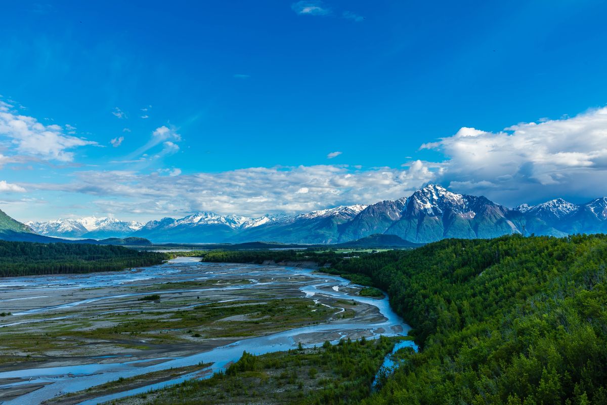
Summer brings green gardens, downtown walks and long evenings for exploring the surrounding Valley. Photo: regional Palmer-area mountain context, not a view from a listed home.
Photo: iStock.com/Alan Musy - ADM PhotoGraphics
Before you buy here
Tap a topic to open the practical checks. One property, one clear review.
City status and services
Match the parcel to city limits, the current utility accounts and applicable city and Borough taxes. A nearby main alone does not establish a connection.
Older-home records
Review foundations, heating, electrical work, additions and permits with your inspector; compare the actual layout with the available records.
Lot and use
Read the survey, setbacks, easements, parking arrangements and any association or covenant documents against your intended use.
Wind, drainage and river context
Look at roof and siding condition, spring drainage and parcel flood mapping. Matanuska riverbank erosion is a separate issue from a mapped flood zone.
Winter and monthly operation
Confirm plowing for the street and access, heating history, insulation and utility costs. Visit at the hour you would actually leave for work.
Sources: Mat-Su Borough — Development Services · Mat-Su Borough — Floodplain Development Permit · Mat-Su Borough — Road Service Area maps
Compare the neighboring areas
Greater Palmer
The unincorporated ring just outside city limits: Inner and Outer Springer Loop and the Old Glenn south toward the Butte. Mostly Borough services, with well and septic common.
Open area guide →Farm Loop
North of town around Farm Loop Road and the Palmer-Fishhook Road: original colony farm tracts, larger lots and newer subdivisions mixed together.
Open area guide →Lazy Mountain
East across the Matanuska River on the lower slopes of Lazy Mountain, reached by the Old Glenn and Clark-Wolverine Road. Wooded lots, hillside driveways and mountain-side homes.
Open area guide →Trunk Road / Gateway
Between Palmer and Wasilla along the Palmer-Wasilla Highway, Trunk Road and the Glenn/Parks interchange. Newer subdivisions and services; addresses may be Palmer or Wasilla.
Open area guide →Explore all Palmer areas, Living in Palmer and the Mat-Su Valley. Planning resources: buying a home, buying land and planning your visit.
City of Palmer: common questions
Is this guide for every Palmer mailing address?
No. It focuses on homes inside the incorporated City of Palmer. Farm Loop, Lazy Mountain, the Butte and other surrounding communities have their own geography and service arrangements.
How does city Palmer differ from Greater Palmer?
The city has a compact downtown and municipal government. Our Greater Palmer guide covers the surrounding unincorporated ring, including the Springer Loop area; the two guides are deliberately separate.
Can I search only in-town homes?
Start with Palmer listings, then use the city outline and individual addresses to narrow the results. James Cash and Ryan Lunski can help turn that into a focused shortlist.
What is a useful first visit?
Combine a downtown walk around the depot and gardens with a drive through residential streets and a stop near Matanuska River Park. Then test the route to your own daily destination.
Let’s turn the map into your shortlist.
Tell James Cash and Ryan Lunski which roads, settings and home layouts caught your eye. We’ll help you compare the actual properties. The Palmer search below is broad—not a polygon-filtered list for this area.
Local sources behind this guide
Researched November 9, 2026 (AKST). Maps are for orientation; current property records and land-manager information control.
Sources: City of Palmer — History of Palmer · City of Palmer — Palmer City Parks · Mat-Su Borough — Matanuska River Park · City of Palmer — Public Works · City of Palmer — Public services, facilities & infrastructure (plan chapter) · Matanuska Electric Association · ENSTAR — Service Lines · Mat-Su Borough — Development Services · Mat-Su Borough — Floodplain Development Permit · Mat-Su Borough — Road Service Area maps · JBER — Base Access / PCS overview · Mat-Su Borough — Community Council Maps · OpenStreetMap landmark locations · OSRM / OpenStreetMap routing · Alaska Municipal League — Palmer (2026 directory)
Photographer credit