


Lazy Mountain: the wooded side of Palmer
Cross the Matanuska River and the landscape changes. Wooded roads and rising ground put the mountain into the property search, while Palmer stays on the other side of the bridge.
Banner: Regional Pioneer Peak and Matanuska River. Photo: iStock.com/Alan Musy - ADM PhotoGraphics. Regional context, not a view from a listed property.
A mountain community, not just a trail name
Lazy Mountain is both a recognizable landmark and the name of the community east of Palmer. This guide is about the residential landscape at its lower elevations and the roads connecting it with town. It is not a description of homes on the summit, nor a claim that the entire council area has the same terrain.
The experience starts with the river crossing. From Palmer, the Old Glenn Highway leads across the Matanuska; Clark-Wolverine Road helps organize the approach into the community. Beyond that, side roads, tree cover and changes in elevation make individual addresses more useful than a broad area label.
This is a place to look carefully at the relationship between a house and its setting. One home may sit in a wooded pocket, another on more open ground, another along a steeper driveway. The mountain backdrop is part of the wider scene, but the view from a particular living room depends on the lot itself. The map gives orientation; a walk around the property gives the detail.
Lazy Mountain on the Palmer map
Gold is this guide’s area; neighboring areas stay grey. Tap a shape for its guide, or a numbered hotspot for a public landmark.
One finger scrolls the page. Pinch or use + / − to zoom. Tap “Move map” to pan with a finger, then “Done moving map” to return to page scrolling.
Boundaries are approximate, not legal lines. Original Palmer outlines are retained from Mat-Su Borough community councils and city limits; Knik River Road is a drawn road corridor. Trail pins use Borough coordinates. Depot and park pins are approximate OpenStreetMap centers, not parking entrances. Public destinations may sit outside this guide’s area.
Sources: Mat-Su Borough — Community Council Maps · OpenStreetMap landmark locations
The bridge is the anchor in your route
Palmer is reached through the Matanuska River crossing and the Old Glenn connection. Clark-Wolverine Road and the local road network distribute trips from there. A short distance on a regional map can include a meaningful amount of local driving before you reach the main road.
For Wasilla, the trip continues across the Palmer side of the Valley toward the cross-town highway network. Anchorage and JBER trips join the Glenn corridor, with the chosen gate or downtown destination making a difference at the far end. The commute buttons use a representative Mercury Avenue point in the Clark-Wolverine road network, not a claim that every Lazy Mountain home has the same drive.
When touring, take time to drive both the town approach and the last residential stretch. Notice how the route fits your actual day: a stop in Palmer, a trip west or a longer southbound commute. Looking at the access pattern alongside the house layout gives you a much clearer comparison than calling everything “minutes from Palmer.”
Where does your day take you?
Tap a destination to compare the same starting point: Mercury Avenue in the Clark-Wolverine road network.
Downtown Palmer · 4.3 miles
Route: Clark-Wolverine Road → South Old Glenn Highway → East Arctic Avenue → South Alaska Street
No-traffic OSRM model estimates, rounded up to five minutes; not measured rush-hour or winter trips. Your driveway, traffic and weather add time. JBER ends at the Boniface Gate checkpoint and excludes queues and travel on base. Choose the gate for your actual destination.
Sources: OSRM / OpenStreetMap routing · Alaska 511 · JBER — Base Access / PCS overview
A choice of public trails, each with its own character
The Borough identifies several public trail destinations in the Lazy Mountain area. At the Lazy Mountain Recreation Area, the direct Lazy Mountain Trail climbs sharply, while the longer Lazy Moose route zigzags uphill and rejoins it. These are distinct ways into the same mountain landscape, not two names for an identical walk.
The Morgan Horse Trail connects the recreation-area side with Maud Road through a lower-elevation setting. Matanuska Peak is another mountain outing in the broader community. Farther toward the Butte, the Plumley-Maud trail and Knik River recreation landscape create a different set of routes and uses.
Use the public trailhead hotspot to see the approach, then use the Borough’s trail information for the outing itself. A house near a mountain is not automatically on a public trail, and we do not suggest crossing private land to reach one. There is plenty to compare just by visiting the proper access point and seeing how that trip fits with the neighborhood roads.
A look around the wider landscape
Swipe the strip, then tap a photo to open it full-screen. These licensed regional images show the wider Palmer and Hatcher Pass landscape—not individual neighborhoods, listings or views promised from a home.
Let the site and the floor plan tell the story
Detached homes, wooded residential parcels, cabins and larger holdings can all appear in a Lazy Mountain search. Some properties emphasize a conventional house and garage; others make the setting or a separate building the main reason to look. Current listings are the source for what is actually available, rather than a fixed description of the inventory.
Hillside and lower-ground homes can have quite different layouts. A lower-level entrance, a deck above sloping ground or a detached workshop changes how you use the property. Tree cover can make outdoor rooms feel tucked in, while open ground brings a different relationship with the mountain backdrop.
Compare the approach, parking area, entry and useful outdoor space as one connected arrangement. That is especially helpful when two houses have similar interior square footage but very different sites. James Cash and Ryan Lunski can focus the search on the combination you want, whether that is a straightforward residential home or a more land-centered property.
A separate geographic identity east of the river
Palmer’s agricultural development provides the wider historical context, but Lazy Mountain has its own community identity. The Borough recognizes a Lazy Mountain Community Council and lists Lazy Mountain Road Service Area No. 19. Its trail system and the Matanuska River edge are useful geographic references today.
Our map reuses the council-based outline already on the Palmer page. That keeps the guides consistent while acknowledging that the council includes more terrain than a single residential neighborhood. We have not attached an invented origin story to the name or called an individual cabin historic without records. The useful local story here is the relationship between the river crossing, settled lower roads and rising mountain landscape.
Household systems on a rural road network
Outside Palmer’s municipal core, properties can have private wells and on-site wastewater systems or other site-specific arrangements. The house’s actual records explain the setup. Regional electricity is provided by Matanuska Electric Association, while the availability of gas and communications services follows the providers’ address-level networks.
A cabin and a full-time house can have very different systems even along the same general route. The size of the heated space, a separate shop and the way water is supplied all shape how a property operates. Keep those comparisons concrete: what is installed, how it has been maintained and how it fits your plans.
Picture your season here
Seasonal notes with illustrative regional photos—not a matched summer/winter photo pair.
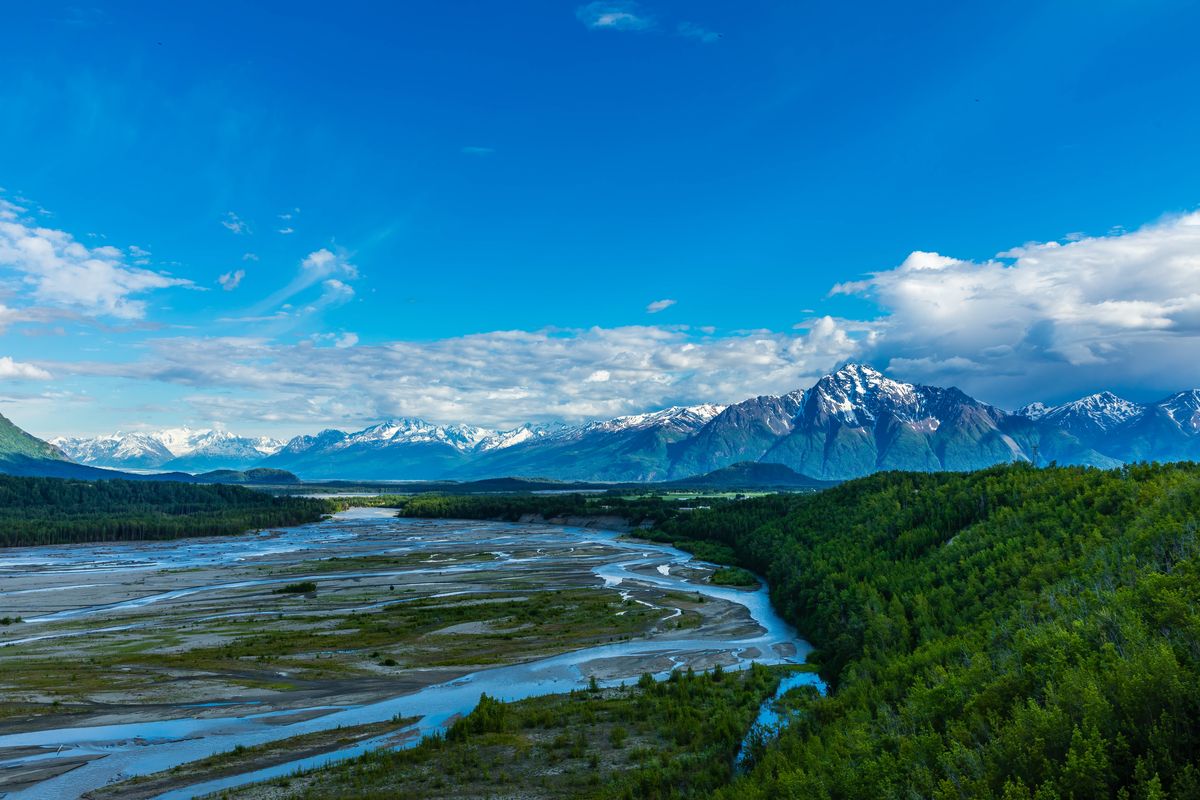
Summer brings leaf cover to the lower roads and a longer window for visiting the public mountain trailheads. Photo: regional Pioneer Peak and Matanuska River, not Lazy Mountain itself.
Photo: iStock.com/Alan Musy - ADM PhotoGraphics
Before you buy here
Tap a topic to open the practical checks. One property, one clear review.
Driveway and road
Confirm legal access, road-maintenance responsibility, plowing, driveway grade, drainage, turning space and how the route works in winter.
Slope and ground
Review the survey, soils, retaining structures, foundations and drainage with qualified professionals. Check riverbank erosion and flood mapping where the parcel approaches the Matanuska.
Water and wastewater
Establish the system type, well yield and water quality, septic as-builts, maintenance and suitability for any proposed change in use.
Use and improvements
Read covenants, plat notes, zoning or special land-use rules and permits for additions, cabins, shops or other buildings.
Heat, exposure and outdoors
Confirm energy systems and service availability, wind exposure, winter sun from the actual lot and current public trail conditions. Nearby mountains do not establish public access across a parcel.
Sources: Mat-Su Borough — Development Services · Mat-Su Borough — Floodplain Development Permit · Mat-Su Borough — Road Service Area maps
Compare the neighboring areas
City of Palmer
Inside Palmer city limits: the historic downtown grid, colony-era streets and newer in-town subdivisions. City services and city taxes apply here in addition to Borough ones.
Open area guide →Butte
South of Palmer between the Matanuska and Knik rivers, around Bodenburg Butte, the Old Glenn and Bodenburg Loop. Farm tracts, acreage and rural residential roads.
Open area guide →Farm Loop
North of town around Farm Loop Road and the Palmer-Fishhook Road: original colony farm tracts, larger lots and newer subdivisions mixed together.
Open area guide →Knik River Road
Across the Knik River: the Old Glenn south of the bridge and Knik River Road heading east toward the glacier valley. Scattered homes, cabins and larger parcels.
Open area guide →Explore all Palmer areas, Living in Palmer and the Mat-Su Valley. Planning resources: buying a home, buying land and planning your visit.
Lazy Mountain: common questions
Is Lazy Mountain a separate city?
No. It is an unincorporated Borough community east of Palmer. This guide uses the existing Palmer map’s council-based outline for orientation.
How do you reach the area from Palmer?
The Old Glenn Highway crosses the Matanuska River, with Clark-Wolverine Road and the local road network providing the approach to much of the community.
Are Lazy Mountain and Lazy Moose the same trail?
They are different routes from the recreation area. The Borough describes the Lazy Moose route as longer and less steep before it rejoins the Lazy Mountain Trail.
What should I compare in the listings?
Look at the house and site together: road approach, entry, parking, useful outdoor space and any separate buildings. Similar-sized homes can have quite different arrangements on wooded or sloping lots.
Let’s turn the map into your shortlist.
Tell James Cash and Ryan Lunski which roads, settings and home layouts caught your eye. We’ll help you compare the actual properties. The Palmer search below is broad—not a polygon-filtered list for this area.
Local sources behind this guide
Researched November 9, 2026 (AKST). Maps are for orientation; current property records and land-manager information control.
Sources: Mat-Su Borough — Lazy Mountain · Mat-Su Borough — Lazy Mountain Recreation Area · Mat-Su Borough — Morgan Horse Trail · City of Palmer — History of Palmer · Matanuska Electric Association · ENSTAR — Service Lines · Mat-Su Borough — Development Services · Mat-Su Borough — Floodplain Development Permit · Mat-Su Borough — Road Service Area maps · JBER — Base Access / PCS overview · Mat-Su Borough — Community Council Maps · OpenStreetMap landmark locations · OSRM / OpenStreetMap routing
Photographer credit