


Greater Palmer on the Palmer map
This area is highlighted. Neighboring areas are shown in lighter color. Open the Palmer Alaska homes for sale hub for every area guide, or pick a shape below.
Areas are approximate – see notes below.
Palmer nearby, with more space between the streets
Greater Palmer is the label our map uses for the unincorporated ring outside the city. Inner and Outer Springer Loop and the Old Glenn approach south of town are its clearest reference points. This is not another incorporated city, and it is not shorthand for every rural property with a Palmer address. It is a useful way to narrow Palmer Alaska real estate that sits just outside town, without treating every rural Palmer address as the same place. Greater Palmer homes for sale sit in that unincorporated ring, not in a second downtown. If you want to buy a home in Greater Palmer, use the Springer Loop and Old Glenn references to see how a lot sits just outside town.
Drive the loops and you can see why this is worth a separate guide. Residential side roads sit alongside open ground and the larger parcel pattern left by Palmer’s agricultural development. Some homes are part of a subdivision; others are organized around a longer driveway, a shop or land that matters as much as the house. The useful comparison is not simply “close to Palmer,” but what kind of property setup you want near town.
Keep the broader map open as you explore. Gateway is the cross-Valley corridor to the west, the Butte is farther south and Farm Loop is north of the city. The community outline helps you understand those relationships without turning an approximate buyer map into a survey.
Start your visit with Inner and Outer Springer Loop
The Springer roads make a practical introduction to this side of Palmer. Connect them with the city streets and the Glenn or Old Glenn, then add the side roads containing homes you want to see. A loop-shaped road network can place two nearby-looking properties on different approaches to your usual destination.
Palmer is the local town reference. For Wasilla, compare the Palmer-Wasilla corridor with the Glenn/Parks connection from the southern side, while an Anchorage or JBER trip eventually joins the Glenn Highway. The Old Glenn has a different role: it leads toward the Matanuska River crossing, the Butte and the Knik River side of the Valley, rather than acting as a substitute for every Glenn Highway trip.
The chooser below starts from a representative Springer Loop road point so comparisons use one consistent origin. A useful showing circuit includes a stop in downtown Palmer, the actual highway approach and the driveway you would use daily. You will understand the layout much better than you would from a list of straight-line distances.
Where does your day take you?
Tap a destination to compare the same starting point: South Inner Springer Loop.
Downtown Palmer · 2.2 miles
Route: South Inner Springer Loop → East Inner Springer Loop → Glenn Highway → West Evergreen Avenue
No-traffic OSRM model estimates, rounded up to five minutes; not measured rush-hour or winter trips. Your driveway, traffic and weather add time. JBER ends at the Boniface Gate checkpoint and excludes queues and travel on base. Choose the gate for your actual destination.
Sources: OSRM / OpenStreetMap routing · Alaska 511 · JBER — Base Access / PCS overview
A town day and a trail day are both within the picture
This area sits between Palmer’s town-center destinations and the wider Valley’s recreation network. The depot, visitor-center gardens and Matanuska River Park belong on a town-side outing. To the west, the Matanuska Greenbelt brings together public trails across Borough, university and state land.
Crevasse Moraine is one named entrance into that trail landscape. Its glacial ridges and hollows give a different feel from the open river scenery east of town. Rather than describing a whole neighborhood as having trail access, we show a real public trailhead on the map. Compare its road approach with the property you are considering.
Southward, the Butte and Knik River communities offer a different set of outings. You do not need to fit all of them into one house-hunting afternoon. Spend time in the part of the landscape you expect to use, whether that is a short walk after errands, a bike ride in the Greenbelt or a longer mountain day on another side of Palmer.
A look around the wider landscape
Swipe the strip, then tap a photo to open it full-screen. These licensed regional images show the wider Palmer and Hatcher Pass landscape—not individual neighborhoods, listings or views promised from a home.
The lot’s layout can be the main feature
The Greater Palmer search is a mix of residential subdivisions, detached houses on larger parcels and farm-style holdings. A listing may put the house first, but a buyer’s real priority might be an existing workshop, a place for gardening or the relationship between the home and its outbuildings. Those are different searches, even when the bedroom counts match.
Walk the property as a working layout. Where would visitors park? How do you get from the house to the shop? Is the outdoor space one useful open area or several disconnected pieces? A long rectangular tract can live differently from a wooded parcel of the same acreage.
The neighborhood label does not establish what a property can be used for. We keep that document work together in the checklist below. For the first shortlist, focus on the combination you want: a house near town, a subdivision arrangement, or land with an existing pattern of buildings and open ground. Then compare like with like.
Reading the agricultural pattern
Palmer’s 1935 colony plan distributed individual 40-acre tracts around a compact settlement. Later subdivision and building have changed many of those holdings, but the agricultural story remains a useful lens for understanding roads, fields and property shapes around town.
The Greater Palmer community council map provides a more specific geographic reference than a mailing address. It is not the same as a voting precinct, and neither one should stand in for the city boundary. Our inherited map uses the council context with the city removed. The familiar road names are the more useful starting point on a visit, while the precise parcel and jurisdiction come from the official mapping.
Rural systems close to a municipal network
Being outside Palmer city limits does not automatically tell you how a home gets water. Private wells and on-site wastewater systems are part of the rural property picture, alongside utility or development-specific arrangements. The City’s planning documents distinguish its utility service geography from its incorporated boundary.
Regional electricity comes through Matanuska Electric Association, and natural gas service follows ENSTAR’s network where available. A detached shop, greenhouse or separate living space can make the service setup a meaningful part of the comparison. Think of utilities as part of how the whole property operates, not a small line at the bottom of a listing.
Picture your season when moving to Greater Palmer
Seasonal notes with illustrative regional photos—not a matched summer/winter photo pair.
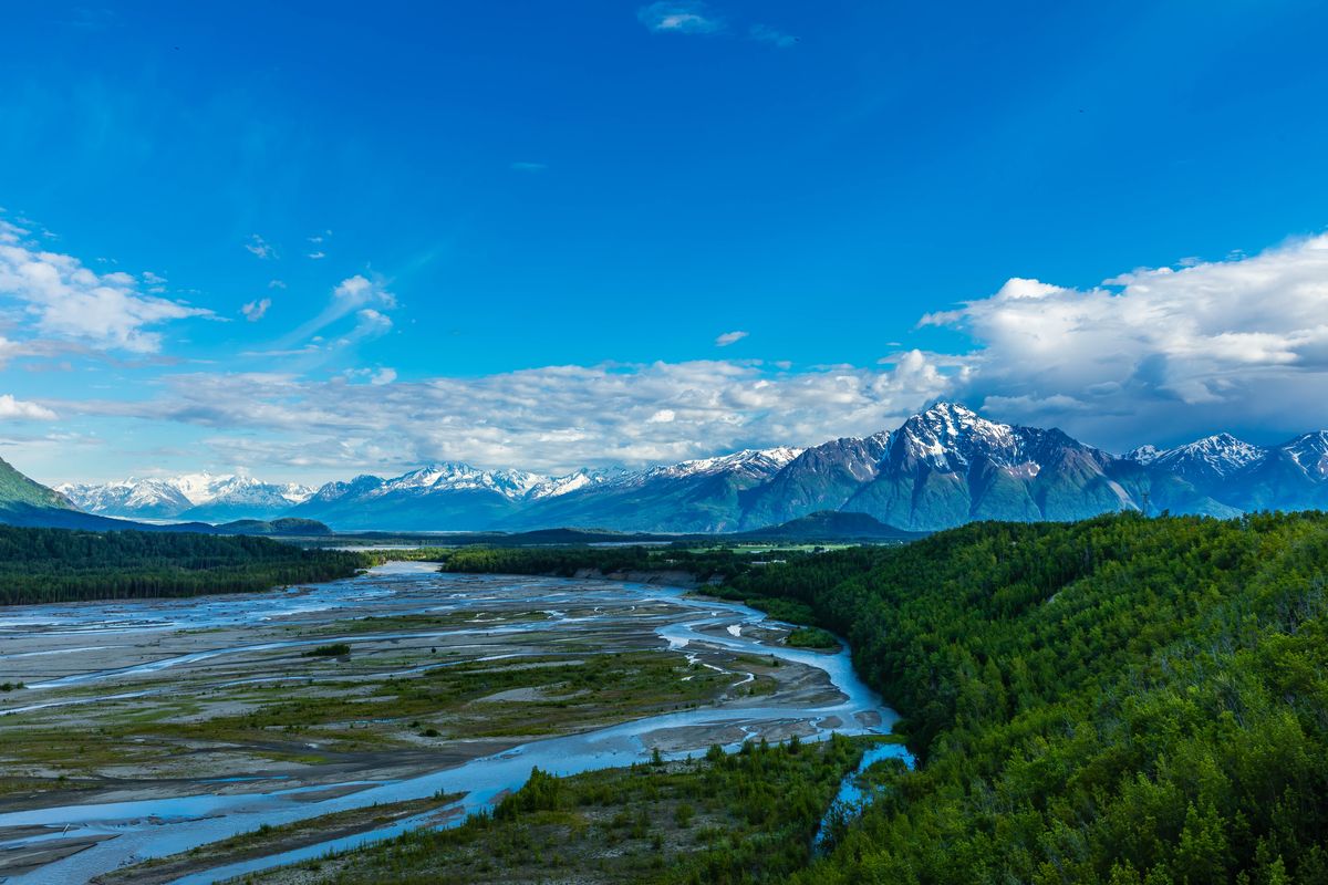
Summer makes the open ground, gardens and outdoor working space easy to read during a visit. Photo: regional Pioneer Peak and Matanuska River context.
Photo: iStock.com/Alan Musy - ADM PhotoGraphics
Before you buy a home in Greater Palmer
Tap a topic to open the practical checks. One property, one clear review.
Parcel and plans
Confirm the city boundary, zoning or special land-use rules, plat notes, covenants and whether your shop, animals or other intended use is allowed.
Water and wastewater
Identify the actual system; review well yield and water quality or utility service confirmation, plus septic as-builts, condition and maintenance records.
Roads and access
Confirm recorded access, easements, road-service coverage and which streets or private drives are actually maintained and plowed.
River, ground and drainage
Check Borough and FEMA flood information, erosion context toward the Matanuska, wetlands and spring drainage. Flood mapping alone does not measure bank erosion.
Buildings and services
Review outbuilding permits and condition, wind exposure, heat, gas availability and electric capacity for the way you plan to use the property.
Sources: Mat-Su Borough — Development Services · Mat-Su Borough — Floodplain Development Permit · Mat-Su Borough — Road Service Area maps
Compare the neighboring areas
City of Palmer
Inside Palmer city limits: the historic downtown grid, colony-era streets and newer in-town subdivisions. City services and city taxes apply here in addition to Borough ones.
Open area guide →Butte
South of Palmer between the Matanuska and Knik rivers, around Bodenburg Butte, the Old Glenn and Bodenburg Loop. Farm tracts, acreage and rural residential roads.
Open area guide →Trunk Road / Gateway
Between Palmer and Wasilla along the Palmer-Wasilla Highway, Trunk Road and the Glenn/Parks interchange. Newer subdivisions and services; addresses may be Palmer or Wasilla.
Open area guide →Farm Loop
North of town around Farm Loop Road and the Palmer-Fishhook Road: original colony farm tracts, larger lots and newer subdivisions mixed together.
Open area guide →Explore all Palmer areas, Living in Palmer and the Mat-Su Valley. Planning resources: buying a home, buying land and planning your visit.
Greater Palmer real estate: common questions
Is Greater Palmer a separate city?
No. Here it means the unincorporated area around Palmer shown on our map, especially the Springer Loop side. It has a different boundary from the incorporated City of Palmer.
Is Springer Loop part of this guide?
Yes. Inner and Outer Springer Loop are key road references. The map is an orientation aid rather than a claim that every street using a Palmer address belongs to this grouping.
What homes should I expect to compare?
Detached homes in subdivisions, larger residential parcels and farm-style properties can all be part of the search. Current inventory changes; focus on the layout and improvements that matter to you.
Which neighboring guide should I open?
Compare Palmer city for an in-town setup, Gateway for the between-cities corridor, and the Butte for the area farther south around Bodenburg Butte and the Old Glenn.
The Palmer search below is broad—not a polygon-filtered list for this area. If you already live here and want to sell a home in Greater Palmer, start with how the property sits in that ring around the city.
Local sources behind this guide
Researched November 9, 2026 (AKST).
Sources: Mat-Su Borough GIS — Greater Palmer Community Council map · City of Palmer — History of Palmer · Mat-Su Borough — Matanuska Greenbelt · Mat-Su Borough — Matanuska River Park · City of Palmer — Public services, facilities & infrastructure (plan chapter) · Matanuska Electric Association · ENSTAR — Service Lines · Mat-Su Borough — Development Services · Mat-Su Borough — Floodplain Development Permit · Mat-Su Borough — Road Service Area maps · JBER — Base Access / PCS overview · Mat-Su Borough — Community Council Maps · OpenStreetMap landmark locations · OSRM / OpenStreetMap routing
Photographer credit
YOUR ALASKA SEARCH
Keep Greater Palmer on your radar
See what is available in the area you just explored, then keep your search close at hand.
On the results page, tap Save Search to save it to your dashboard and set up email alerts. Sign in or create your account if prompted, then choose your alert settings.