


North Star Anchorage homes & area guide
Between the Chester Creek corridor and Midtown’s streets, North Star deserves a closer look than a broad central-Anchorage search can give it.
Banner: Downtown Anchorage at sunset — city context, not this neighborhood or a listed-home view. Photo: iStock.com/Jacob Boomsma.
A smaller lens on central Anchorage
North Star is its own community council area, not a replacement label for all of Midtown. The current municipal outline places it along the Chester Creek side of the central bowl. Midtown, Spenard and Fairview are useful surrounding comparisons, but their guides answer broader or different geographic questions.
This is a search where the relationship between a residential street and a major corridor matters. Two addresses that seem close on a citywide map may face different approaches, crossings and parking arrangements. Begin with the house’s access point and work outward rather than treating every central address as interchangeable.
The highlighted outline makes the comparison manageable. It is not an MLS district, a subdivision plat or an instruction to exclude a property that meets your needs just beyond the edge. Keep the individual home and your actual routine at the center of the decision.
North Star on the Anchorage map
Gold highlights this guide. Grey shapes provide nearby civic geography. Tap a shape for its guide or a numbered pin for a public park.
One finger scrolls the page. Pinch or use + / − to zoom. Tap “Move map” to pan, then “Done moving map” to return to page scrolling.
Lightly simplified MOA council outlines retrieved November 9, 2026 (AKST). These are orientation and search areas, not MLS, subdivision, parcel or legal boundaries. Park points are inside official municipal park polygons: not trailheads or parking entrances. Some destinations are outside the gold area. Use the operator’s map for public access.
Follow the street connections, not just the map distance
Arctic Boulevard and the central north–south corridors provide useful orientation, while the Northern Lights and Benson pair are important references on the Midtown side. Chester Creek is a trail corridor, not a through street. A route by bicycle or on foot can differ substantially from the route by car.
Trace the first and last parts of your normal trip. Where do you cross a major road, where do you turn back toward the house, and is parking directly off an arterial or reached through a local street? Those small details are easy to miss when comparing only the distance to downtown.
No commute time is promised here. Test your own destination at the relevant hour and account for weather, road work and the return trip. If public transportation is part of the plan, consult current People Mover routes and stop locations rather than relying on a static neighborhood summary.
Valley of the Moon as a real public reference
The Municipality lists Valley of the Moon Park at Arctic Boulevard and Chester Creek. It is a useful public landmark for understanding North Star’s relationship to the greenbelt. The park and creek corridor are not private amenities attached to every nearby listing.
Walk the public approach you would use from an actual property, observing crossings and the position of the entrance. A house can be close to a park boundary while the usable entrance is somewhere else. Do not infer a trail easement across a yard from an aerial image.
For a wider greenbelt comparison, Eastchester Park lies farther east along Chester Creek. Its improvement page distinguishes emergency crossing repairs completed in 2026 from a later replacement project. Check current notices for access rather than treating the whole corridor as permanently unchanged.
See the wider Anchorage setting
Swipe, then tap a licensed photo to open it full-screen. These show downtown and the wider Municipality—not this neighborhood, a listing or a view promised from a home. A local-photo slot is clearly labeled until an approved photograph is available.
Shared buildings and individual lots need different questions
A central Anchorage search can include detached houses, attached homes, condos and multi-unit properties. In North Star, use the polygon to focus the geography, then use current listings to establish what is actually available. The area name is not evidence of a particular floor plan, garage arrangement or association.
At a condo or attached property, establish which surfaces and systems are shared, what the dues cover and what maintenance is anticipated. At a detached house, look at the yard, access, storage and the relationship to the street. At a small multi-unit, confirm permitted use and the actual operation of each space.
Compare how an entrance works during ordinary routines, not just during an open house. Where would boots, equipment and deliveries go? James Cash and Ryan Lunski can help sort those practical priorities before widening the search into all of Midtown.
The greenbelt is context, not a parcel report
Chester Creek gives this part of Anchorage a clear geographic reference, but a council map does not describe the drainage or ground conditions at an individual house. Review the survey, available hazard mapping and inspection findings for the specific site. A nearby waterway is a reason to ask better questions, not to make a prediction about the property.
City services also need address-level confirmation. Identify the actual water, wastewater, heat and communications arrangements, and inspect the installed equipment. A utility line drawn on a map does not prove a building is connected or that its private service line is in good condition.
The council page provides an independent place to follow public land-use discussions. Check the date and stage of any proposal before treating it as part of the home’s current setting.
Picture the season. Check the actual property.
Tap for seasonal planning notes. The photos are licensed wider-Anchorage context, not a matched pair from this neighborhood.
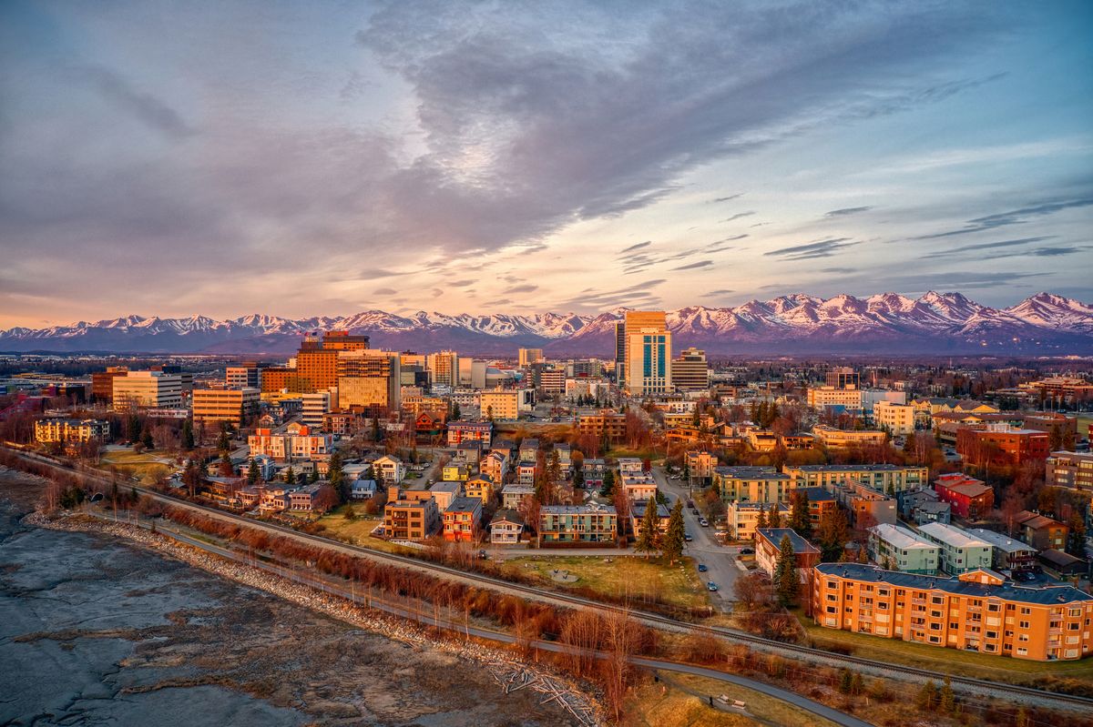
Try the public greenbelt approach and compare outdoor space at the actual property. Consider the road crossings between a home and your chosen park entrance. Photo remains downtown context; this is a planning-note toggle, not a matched seasonal photo pair.
Photo: iStock.com/Jacob Boomsma
Before you buy: one property, one clear review
Tap a topic. These are questions to verify, not conclusions about a neighborhood.
Parcel, use and alterations
Compare the survey, municipal zoning and recorded restrictions with your intended use. Confirm permitted dwelling count and records for additions or conversions. An extra kitchen, separate entrance or large lot does not establish a permitted use.
Structure, ground and drainage
Ask your inspector about the foundation, roof, drainage, heating and documented repairs. Review available parcel hazard mapping and site-specific reports where relevant. A council map is not an engineering or condition assessment.
Shared buildings and operating records
For a condo or attached property, read the declaration, maintenance responsibilities, reserves, insurance, minutes and proposed assessments. For a rental property, review actual leases, deposits, utility allocation and collected income separately from projections.
Services, parking and winter operation
Confirm the actual utility connections, private service-line responsibilities, heating records and communications options. Check recorded access, parking rights, snow storage and who maintains each public or private road segment.
Public land and your real daily route
Use designated public park entrances and current operator notices. Confirm any claimed private access or easement in the records. Test your actual destination and return trip; a nearby highway, campus or base boundary is not a travel-time or access promise.
General information only—not engineering, legal, tax, lending or inspection advice.
YOUR ALASKA SEARCH
Keep North Star on your radar
Open the area-shaped search, then save it to follow new listings without restarting your search.
On the results page, tap Save Search to save it to your dashboard and set up email alerts. Sign in or create your account if prompted, then choose your alert settings. Opening this link alone does not activate alerts.
One closed polygon follows a simplified version of the MOA council outline. It is not an MLS, parcel or legal boundary. Edge listings may be included or missed; confirm individual property locations. Current inventory is on the results page, not a fixed count in this guide.
Compare places, not rankings
Fairview
Open the separate guide and compare the actual geography and properties.
Explore this area →Rogers Park
Open the separate guide and compare the actual geography and properties.
Explore this area →Taku / Campbell
Open the separate guide and compare the actual geography and properties.
Explore this area →Midtown
Open the separate guide and compare the actual geography and properties.
Explore this area →Spenard
Open the separate guide and compare the actual geography and properties.
Explore this area →Downtown
Open the separate guide and compare the actual geography and properties.
Explore this area →Existing Chester Creek page
Open the separate guide and compare the actual geography and properties.
Explore this area →Keep the broader Anchorage guide open, or explore Eagle River, Wasilla and Palmer.
Planning resources: Buying a home, Buying land and Plan your visit.
North Star: common questions
Is North Star the same as Midtown?
No. North Star is its own council area beside the Chester Creek corridor. The existing Midtown guide remains the broader central-bowl comparison.
Does being near Chester Creek mean direct trail access?
No. Use public entrances and confirm any recorded access rights. A nearby greenbelt does not create an easement across private property.
Why use a council outline for a search?
It is a real, publicly mapped starting geography. The search ring is simplified for the listing system, and edge properties still need an address check.
Turn the outline into a property shortlist.
Tell James Cash and Ryan Lunski which routes, building arrangements and outdoor spaces matter to you. We’ll help compare actual homes and the records behind them—not just an area label.
Keller Williams Realty Alaska Group
Properties of Alaska by HERO Realty Group
Sources behind the geography
Researched November 9, 2026 (AKST). Current municipal council and park GIS, council information and land-manager project pages support this guide. Project dates can change; current property records and operator notices control.
Photographer credit